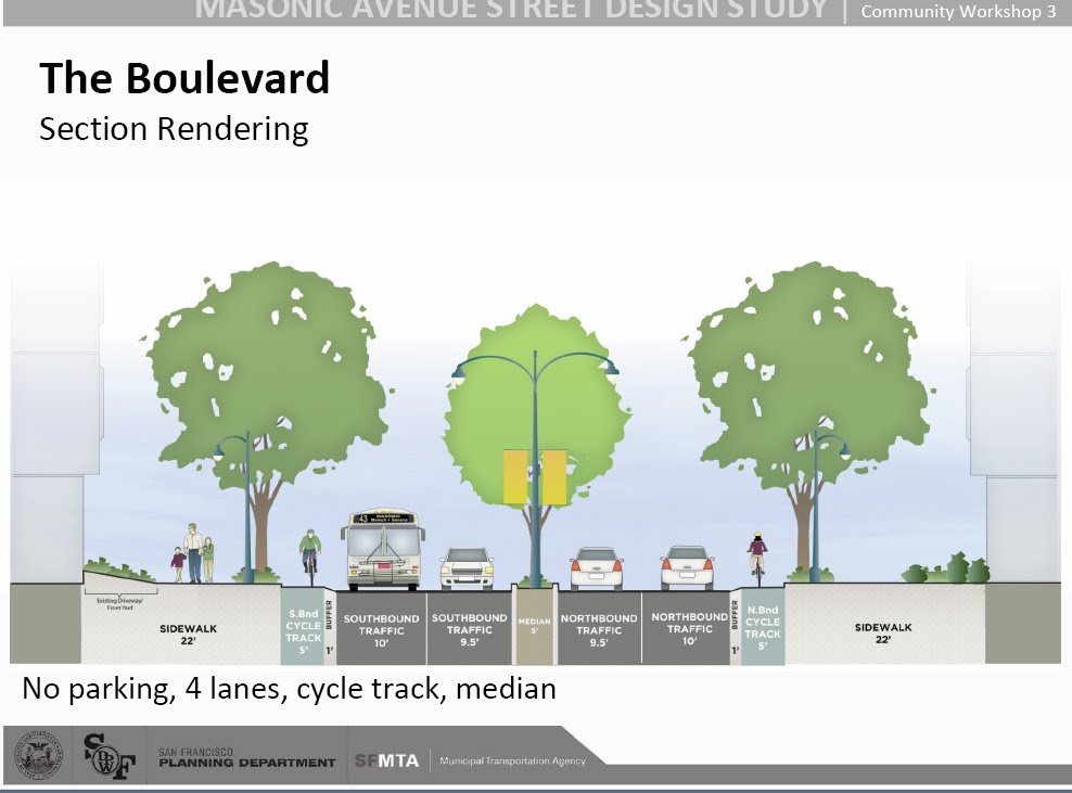
A major political concern in campaigns for change is who is backing what side of the debate. Bike Nopa has posted survey results from the SF Planning Department on a recent proposal for Masonic — to remove parking and replace it with a bike lane — that supposedly shows locals were informed and supportive.
That’s a familiar-looking map to anyone who watched my RSA presentation last February on network attack source attribution using Smith’s 1860s Ghost-Map. It makes me wonder if anyone has calculated the distance to safe zones for non-vehicular travel for NOPA residents.
Despite 1400 notices sent by the city it appears only a handful of responses were recorded. Bike Nopa points out that those who did participate the most in meetings (86% in favor) were local rather than from advocacy groups or other neighborhoods.
It makes a lot of sense when you think about who would support bike and pedestrian improvements — people who are close enough to the area to bike or walk through it. Nonetheless, it’s an interesting use of data relative to safety studies.
Here’s the new design, reminiscent of urban plans common to Europe and Asia, which adds a buffer for pedestrians, many new trees and a raised bicycle lane:
