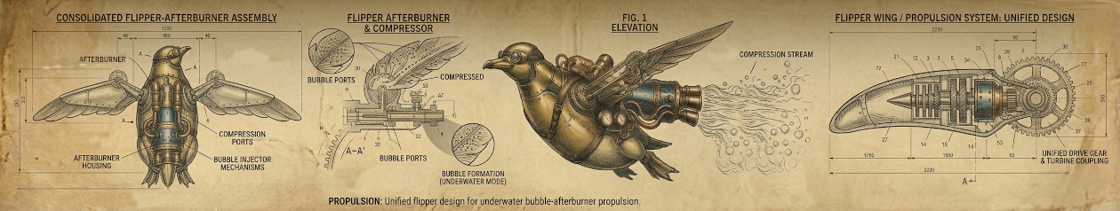
…while economic competitiveness is at some level a strategic need, the particular defense of a US Company is not something the NSA can and should prioritize. The answer to this problem is allowing private companies to offer their services under strict law enforcement and intelligence community oversight to perform the actions needed, including remote intrusion, data exfiltration and analysis, that would allow US Steel and the US Government to build a rock-solid case for criminal liability and sanctions. In that sense, cyber Letters of Marque are more similar to private investigator licensing than privateer licensing.
To me this misses the real point of letters of marque. An extension of government services under license is approaching the for-hire contract system as used already. The infamous Blackwater company, for example, implemented privatized security services.
We are trying to do for the national security apparatus what FedEx did for the Postal Service
Let me set aside a US-centric perspective for a moment, given that it has not ratified the 1856 Declaration of Paris signed by 55 states to formally outlaw privateers. Arguably this is because American leaders thought they never would want or have a standing military and thus would rely on privateers for self-defense against established European armies. The Constitution Article 1, Section 8 still has letters of marque as an enumerated power of Congress.
To declare War, grant Letters of Marque and Reprisal, and make Rules concerning Captures on Land and Water;
To raise and support Armies, but no Appropriation of Money to that Use shall be for a longer Term than two Years;
Note that 2 year limit on funding Armies. US Congress right now can issue a letter of marque to private entities, who would be given neither funding nor oversight, so they can submit prizes won to a court for judicial determination.
On a more global note what really we ought be talking about here is how someone wronged directly can take action, akin to self-defense or hiring a body-guard, when their government says an organized defense is unavailable. A letter of marque thus would be offered as license to defend self in consideration of a court after-the-fact, where a government entity can not help.
In historic terms (before 1855) any authority might issue a letter to “privateers”; spoils of enemies found were to be brought back to that issuer’s court for settlement. Upon seizing goods the privateer returned to an admiralty or authority for assessment in what we might call a “spoils court”.
An excellent example of this was when two ships with American flags attacked a British ship because at war. A fourth ship sailed late into this battle flying a British flag and chased away the two American ships. Sounds like a simple case of British nation-state defending self against two American privateers, right?
No, this fourth ship then dropped its British flag, raised an American one, and scuttled the already heavily damaged British ship that it had pretended to defend. Now acting as an American privateer it could enter an American port alone with enemy spoils as a “patriotic” duty under a letter of marque. Had the fourth ship simply helped the other two American ships a spoils court would have awarded at most a third of the full sum it received.
The use of an authority for judgment of spoils and settlement is what distinguishes the “patriotic” privateers from pirates who operated independently and eschewed judgment by larger global organizations (pirates often were those who had left working for large organizations and set out on their own specifically to escape unjust/unhealthy treatment).
So I say letters of marque have a different and more controversial spin from the licensing or even a contractor model mentioned above in Aitel’s post:
…allowing private companies to offer their services under strict law enforcement and intelligence community oversight to perform the actions needed…
We seek to maintain accountability while also releasing obligation for funding or strict coordination by an authority. This takes us into a different set of ethics concerns versus a system of strict oversight, as I illustrated with the American ship example above. Ultimately the two wronged American ships had recourse. They sued the fourth ship for claiming spoils unfairly, since it arrived late in the battle. Courts ruled in their favor, giving them their “due”.
Here’s a simple example in terms of US Steel:
The US government finds itself unable to offer any funds or oversight for a response to attack reported by US Steel. Instead the government issues a letter of marque. US Steel itself, or through private firms it contracts, finds and seizes the assets used by its attackers. Assets recovered and details of case are submitted to court, which judges their actions. Spoils in modern terms could mean customers, IP or even infrastructure.
In other words, if US Steel finds 90% of IP theft is originating from a specific service provider, and a “take over” of that provider would stop attacks, the courts could rule after US Steel defends itself that seized provider assets (e.g. systems and their networks found with IP stolen from US Steel) are a “prize” for US Steel.
It’s not a clear-cut situation, obviously, because it’s opening the possibility of powerful corporations seizing assets from anyone they see and think they can take. That would be piracy. Instead accountability for prizes is considered by authority of courts, to reduce abuse of letters.
Charlotte, North Carolina, has a “Confederate” history marker that I noticed while walking on my way into meetings at Bank of America headquarters.
It is in need of major revision, if not removal.
Let me start this story at the end. My searches online for more information eventually found a “NC Markers” program with an entry for L-56 CONFEDERATE NAVY YARD.
Closer to the end of the war…tools and machinery from the yard were moved from Charlotte to Lincolnton. Before the yard could be reassembled and activated in Lincolnton, the war ended. After the war the yard’s previous landowner, Colonel John Wilkes, repossessed the property, for which the Confederate government had never paid him. Where the Confederate Navy Yard once operated, he established Mecklenburg Iron Works. It operated from 1865 until 1875 when it burned.
Please note the very vague “the war ended” phrase in the second sentence.
This supposedly historic account seems to obscure the very simple fact that white supremacists lost the war they started to expand slavery.
I find saying “the war ended” to be an extremely annoying attempt to avoid saying who lost.
The exact date of the formation of the Mecklenburg Iron Works is unknown, as is ownership of the firm until its purchase in 1859 by Captain John Wilkes. There is evidence, though, that the firm existed as early as 1846. The son of Admiral Charles Wilkes, John was graduated first in his class at the U.S. Naval Academy in 1847. Following a stint in the U.S. Navy, Wilkes married and moved to Charlotte in 1854. Two years after he purchased the iron works, the Confederate government took it over and used it as a naval ordnance depot. After the Civil War, Wilkes regained possession of the Iron Works, which he operated until his death in 1908. His sons, J. Renwick and Frank, continued the business until 1950, when they sold it to C. M. Cox and his associates.
So many things to notice here:
Confederates appropriated a firm in their war to expand slavery, and possession was returned after they lost that war.
There was a Captain John Wilkes, not Colonel, although neither story says for which side he fought. An obituary lists him as U.S. Navy and says he was active during Civil War
Captain John Wilkes was the son of infamous Union Navy Admiral Charles Wilkes, who was given a court-martial in 1864. Was John, son, fighting for the North with father, or South against him?
There is evidence these Iron Works were established long before the Civil War. NC Markers says “as early as 1846”. The Charlotte library says Vesuvius Furnace, Tizrah Forge and Rehoboth Furnace were operating 35 years earlier, with a picture of the Mecklenburg Iron Works to illustrate 1810.(1)
Wilkes was not just “yard’s previous landowner”, he ran an iron works two years before the Confederate government took possession of it. Did he lose it as he went to fight for the North, or did he give it to help fight for the South? Seems important to specify yet no one does. In any case the iron works was pre-established, used during Civil War and continued on afterwards
The bigger question of course is who cares that there is a Confederate Navy yard in Charlotte, North Carolina? Why was a sign created in 1954 to commemorate the pro-slavery military?
Taking a picture of the sign meant I could show it to an executive business woman I met in the Charlotte airport, and I asked her why it was there (as I asked literally every person I met about the sign).
She told me with a wry smile the “Democrats put up that sign for their national convention”. Such a strangely political answer about the Democrats in her very authoritative voice while being completely wrong.
She both seemed opposed to the sign because of who put it up, yet in no way interested in taking it down. No, keep it up, she said, so people know how bad Democrats are, without any way to know it has anything to do with them (it doesn’t). She ended with an explanation that there was no mention of slavery because (yelling at me and walking away) “CIVIL WAR WAS ABOUT TAXES, NOT SLAVERY. I KNOW MY HISTORY”.
Apparently white educated elites in North Carolina somehow have come to believe Civil War was not about slavery. She was not the only one to speak this lie.
What actually happened with the sign, I found with a little research, was related to the North Carolina Highway Historical Marker Program started in 1935.
They put up the signs after Hitler seized power in Germany and southern aristocrat money flowed to help Mussolini, with no mention of Democrats or political conventions, as you can tell from the link I already gave at the start of this post.
Here is the kind of one-sided “history” the program shamelessly promoted, wrongly calling the preservation of a Union of States by its own forces an “invasion” and then “occupation”.
Historian pro-tip, you aren’t technically an occupying army when you still are in your own country, even if in an attempted secessionist territory. Can’t occupy yourself any more than Ukraine can occupy Crimea.
Otherwise we would still have to say to this day that American troops are invading North Carolina when they are assigned to Fort Bragg. Actually, I’m sure airport lady would say that.
Speaking of Fort Bragg it was opened in 1918 (under racist “America First” President Wilson) and stupidly named after the Confederate General Braxton Bragg.
Bragg is said by historians to have been the worst tactician in the entire Civil War, causing major losses through incompetence that led to defeat of the pro-slavery forces.
Aside from perpetuating his racism, what possible reason would North Carolina have to name a U.S. Army fort after such a terrible enemy military leader known for losing battles let alone wantonly shooting his own men?
How could anyone in North Carolina been proud of Bragg?
For residents the presence of a state marker in their community can be a source of pride
Source of pride.
Honestly I do not see what they are talking about. What are people reading this sign meant to be proud of exactly? Is a failed attempt by pro-slavery military to create a Navy a proud moment? Confederate yards failed apparently because of huge shortages in raw materials and labor, which ultimately were because of failures in leadership. That is pride material?
What am I missing here?
The sign is dated as 1954. Why this date? It was the year the U.S. Supreme Court struck down “separate but equal” doctrine, opening the door for the civil rights movement. It was the year after Wilkes oldest surviving child died. Does a pro-slavery military commemoration sign somehow make more sense in 1954 (city thumbing nose at Supreme Court or maybe left in will of Wilkes last remaining child) than it does in 2016?
Students and faculty immediately objected to this language, which 1) failed to acknowledge slavery as the central cause of the Civil War, 2) ignored the role white supremacy played in shaping the Lost Cause ideology that gave rise to such memorials, and 3) reimagined the continued existence of the memorial on our campus as a symbol of hope.
[…]
From the 1870s through the 1920s, memorial associations erected more than 1,000 Confederate monuments throughout the South. These monuments reaffirmed white southerners’ commitment to a “Lost Cause” ideology that they created to justify Confederate defeat as a moral victory and secession as a defense of constitutional liberties. The Lost Cause insisted that slavery was not a cruel institution and – most importantly – that slavery was not a cause of the Civil War.
Kudos to the Mississippi campaign to fix bad history and remove Lost Cause propaganda. The North Carolina sign’s 1950s date suggests there might be a longer period of monuments being erected. When I travel to the South I am always surprised to run into these “proud” commemorations of slavery and a white-supremacy military. I am even more surprised that the residents I show them to usually have no idea where exactly they are, why they still are standing or who put them up.
Anyone who knows me well knows I walked into Bank of America and at the start of the meetings demanded an explanation for the sign outside. The response I heard was “what sign, never seen it” followed after the meeting by a call from someone asking how dare I mention the sign in a business meeting.
My response? How dare you put that sign in front of my meeting and tell me I can’t talk about it being a bad one.
At the very least North Carolina should re-write this sign to be accurate, if they can’t do the more obvious fix of removing it.
Here is my helpful suggestion:
MECKLENBURG IRON WORKS: Established here 1810. Pro-slavery militia in 1862 seized the works in a failed attempt to supply a Navy after their defeat in Portsmouth, Va. Liberated from occupation 1865.
…in time it began to encounter difficulty obtaining and retraining trained workers
Too vague. I would revise that like this.
Southerners depended heavily on immigrants and Northerners for shipyard labor. As soon as first shots were fired upon the Union by the South, starting a Civil War, many of the skilled laborers left and could not be replaced. Over-mobilization of troops further contributed to huge labor shortages.
NC Markers also wrote:
…given its location along the North Carolina Railroad and the South Carolina Railroad, it was connected to several seaboard cities, enabling it to transport necessary products to the Confederate Navy
Weak analysis. I would revise that to this.
Despite creating infrastructure to make use of the Confederate Navy Yard it had no worth without raw materials. Unable to provide enough essential and basic goods, gross miscalculation by Confederate leaders greatly contributed to collapse of plans for a Navy.
But most of all, when they wrote “the war ended” I would revise to say “the Confederates surrendered to the Union, and with their defeat came the end of slavery”.
Let residents be proud of ending the pro-slavery murderous choke-hold on America, or more specifically returning the Iron Works to something other than stupidly fighting for perpetuation of slavery.
So here is the beginning of the story, at its end. Look at this sign on the street in Charlotte, next to Bank of America headquarters:
Part three: Reprint of a first-person account called “The Little Can That Could“
Part four (bonus!): Why Charity Water Wells May Be Worse For Women Than Long Walks With Cans
Once upon a time I sailed half-way across the Pacific Ocean with the typical yellow fuel can lashed to the deck.
The yellow Jerry can has specific meaning to me — diesel fuel — which I thought was a standard. Yet recently I found a charity worker showing me yellow cans of… water with smiling children, as they asked me to donate funds.
Stock photos of happy smiling children, poor children, playing with yellow cans; this looked weird to me. I wanted to see charts of health and safety data from operations, not ignorance of toxicity from unsafe oil handling/disposal.
Flashy photos provided questionable value to me, or the opposite…made me curious about what might really be lurking beneath such shallow propaganda.
Is this really any different than children miners (minors) grinning through the toxicity of their forced labor environment?
After 1842, no child under the age of ten was allowed to work underground
Yellow cans in obviously staged photos seemed to be encouraging me to accept that children using them for water is some kind of acceptable normal. In fact the unsettling appearance of a fuel can in the hand of smiling children supposedly can be seen “everywhere”, as they have written without irony:
You’ve seen it everywhere on our site, at our events, on our shirts… tattooed on our arms… and although the Jerry can has become a mainstay for our staff and supporters, we want to let you know what it actually is and why it’s a symbol of the charity: water mission.
The diesel can a symbol of a water mission? “Our site, our events, our shirts, our arms”. Note the emphasis on “our” mainstay, rather than a mainstay of the people being helped. My definition of everywhere is a bit broader. Is this a mission to convince staff and supporters that a yellow can should become a symbol of water or that it already has? Because…why?
Something smelled funny. Globally I had learned in my travels, regardless of continent or sea, yellow cans meant one thing, and it was NOT water. Yellow often is used for warning signs; first-hand experience around the world has associated yellow cans with sickening slicks and fumes of poison.
Red gasoline cans, yellow diesel cans. Those are the ones you DO NOT DRINK from let alone touch and breathe. Often we would end up scrubbing and wiping the nearly permanent mess of petroleum around those cans.
And yet, because standards change, I still am open to be convinced otherwise if someone can show data.
Surely there are cases (no pun intended) where options are limited, and people have to make do with what little they have. Reuse of fuel cans for water? Sounds like an indicator of desperation or lack of regulation. Is this evidence of the need for many more white or blue cans?
Globally white and blue are used to symbolize health and safety (e.g. Blue Cross, Blue Shield, U.N. Department of Peacekeeping Operations blue hats and helmets, as well as the white helmets with blue suits of disaster relief workers)
Singapore disaster team prepares for Nepal. White helmets and blue suits (“clouds in the sky”) indicates neutral or safe. Yellow indicates warning or caution.
I mean we are talking about a charity here, where setting a new standard of good is supposed to be the mission, especially where health risks are found. For a charity with wealthy backers and industrial input the choices obviously are many, so the standard should be high. There is great risk in using charity to reinforce harmful behavior.
Confused by charity workers flashing smiling kids in your face to get your money? Me too.
How did someone decide, of all the options, to adopt yellow cans as a sign of health, a symbol for “clean” anything? And why are they just showing stock photos to get donations instead of any real data?
What comes next, bright red oil barrels for charity:meal?
Let’s forget I asked that…although to be fair red in this case could make sense to warn people about heat and to stay away from the barrels.
I searched for answers and some history on can safety. Either I would become convinced that it now is safe for people to drink from yellow cans, and it is safe to give this charity money, or that existing standards need to be defended and propaganda exposed.
My search led to some very interesting surprises.
The charity website reduced my confidence in their ability to collect and analyze data, for example. You might say my opinion worsened as I read through apologetic narratives about Nazi Germany.
Here are four examples, paragraph by paragraph, of what I found and why this charity is so wrong:
To most people, this simple metal or plastic can means ‘gasoline,’ and rightfully so — the first Jerry cans were introduced as gasoline containers by the German military at the start of World War II.
There was some kind of war, a second world war, and this military from Germany that had to go to war also had some need for gasoline, see…
False.
Jerry cans existed during the Spanish Civil War of 1936, years prior to the start of WWII. These cans served both as fuel and water containers, which we know because they were stamped with clear markings for their purpose.
Germany was involved with and supported other fascist militarism. Someone within the growing Nazi war machine was looking at how to improve a fuel can long before Hitler mobilized troops on 15 March 1938 (passive capitulation of Czechoslovakia) or 1 September 1939 (1.5 million marched into Poland, conquering 140 miles in just one week).
I believe the real story goes to lessons in vehicle support and supply containers (e.g. evaporation/expansion) derived from Italian invasion (3 October 1935) of Ethiopia and there is evidence cans were modified and tested during Nazi support for fascists in the Spanish Civil War (17 July 1936).
Handling chemicals in extreme conditions had forced Italy and Spain to innovate their cannister technology. For example the Italians had developed new mustard gas and new bombs to drop on hospitals and ambulances flying the red cross (infamously killing Swedish medical leaders Fride Hylander and Gunnar Lundström).
December 1935 Dolo Ethiopia Italian Bombing Killed Dr Lundstrum in Ambulance
This day is still called “darkest in the history of the International Red Cross“; worth reading if you want to get a sense of how in 1936 a rapidly expanding fascist offensive led to a quickening pace of technology change.
Does the can mean gasoline? The phrase “to most people” used by this charity indicates they have some kind of data or source to check, yet none is provided.
I would say to most people the Jerry can means more than gasoline. It means a variety of fuels and even water. My data on this is based on search engines where the top results are “Jerry Cans – Fuel, Water, Diesel, & Accessories” and “can be used for fuel and drinking water”. The word gasoline does not come up easily.
It is true that 1930s Germany used gasoline for their vehicles. However even they stamped their fuel cans with the generic word Kraftstoff (fuel) or with Wasser (water). The Wasser cans also were painted with broad white lines to ensure it could not be confused with Kraftstoff.
This says to me that today’s use of yellow color on a can would, like the Nazis originally intended, help differentiate unsafe fuel cans. Here is what a Nazi water can, stamped with Wasser and painted with white lines, looks like:
So to most people I think it fair to say the Jerry can means various liquids, not simply gasoline, and most people expect consistent symbols and use to avoid mixing them.
Moving everyone to think of yellow as safe for water seems doable, although expensive and risky, as it really has to be clear where diesel and water are to be found. It seems like a lot of extra work/cost because of confusion, as a friend recently put it:
Whoever made the almond-milk carton the exact same shape as the chicken-broth carton should have to eat this cereal.
Labeling/testing yellow Jerry cans on a massive scale as safe for water seems much, much more complicated and risky than just continuing to use the existing standard of white or blue water cans.
These five-gallon cans, also called ‘Jeep cans’ or ‘blitz cans’ (or, in Germany, ‘Wehrmachtskanisters’) were made of steel and usually sat in the back of vehicles as a reserve tank of gas.
In Germany there were these things with a funny German name in the back of vehicles, kind of like a Jeep, used for an afternoon blitz…
Misleading.
Wehrmachtkanisters means “army can”. Fascists who initiated war without provocation strapped multiples of cans to the side of their vehicles during invasions of foreign countries. In theory the blitzkrieg (German for “lightning war”) was a strategy of very brutal and fast advances to rout an enemy before they could respond.
Obviously there is less surface area in back (width versus length of a vehicle) so lashing cans to the sides has many advantages: leaves space available and makes use of open spaces, balances weight more evenly, while keeping nasty toxic fuel away from doors, passengers and gear. Use of the sides also means the back can be used for less durable/convenient assets and for giant doors and loading (e.g. troop deployment from trucks).
You may notice the white broad lines on some cans, clearly indicating Wasser instead of Kraftstoff.
You will find the same behavior on a boat that has to cross an ocean, as you saw at the start of this story. Reserve cans are balanced on either side, not in the back. It would be stupid to weigh down the back of a vehicle/boat with a dozen cans when sides are empty.
Now lets talk about gallons. Jerry cans are 20L capacity and stamped with this unit — about 5.28 US gallons or 4.40 UK gallons. Jerry cans were not “5 gallons” as Charity:water seems to believe. I find it very odd an international organization would use gallons, let alone not specify a system of gallons. Liters are the original and obvious measurement. Someone thinking in gallons has imposed a very narrow and inaccurate perspective over reality.
In terms of material the cans were not only steel; what made Jerry cans most notable in terms of material was a synthetic lining unlike other metal cans. Plastic cans, or even kevlar-lined battle containment for fuels, today could perhaps be linked to the synthetics of the Jerry can.
In terms of brand association, Jerry cans weren’t used by Jeeps until many years later. I am not sure why Jeep gets brought in so subtly next to “blitz cans”. It strangely brands a pre-existing can with a trademark of a specific American vehicle despite the cans not being developed for it originally and being used much more widely. Perhaps Charity:water is thinking ahead about the power of branding and hopes someday we’ll call them Charity:cans?
Speaking of American trademarks, “Blitz” reminds me of a sad and strange twist in history. As I explained above the word means lightning in German; a military campaign tactic attributed to the Nazis. It also refers to a specific 1940 bombing campaign meant to demoralize the British by killing civilians and destroying industry. Not the best connotations. With that in mind an American manufacturing company made the odd decision to adopt it as a name for their “improved” version of Jerry cans.
Originally a US metal container company that made Jerry cans in the 1940s used the words “metal container” in their name. They grew so large and successful that 50 years later the vast majority of American fuel cans were made at this “U.S. Metal Container” (UMC) company. When UMC moved its production away from metal to making only plastic cans in the 1990s they changed their name.
Instead of just switching to the acronym UMC, which would have been clever and celebrating American military history, they adopted the infamous Nazi term “Blitz” as their name because, well, UMC was located in Oklahoma. It should be no secret that neo-nazis and Hitler apologists lived an open life in Oklahoma. But I digress…
Anyhow after changing its name to the Nazi “Blitz” and moving everything to plastic production this venerable Jerry can manufacturer (that perhaps even helped defeat Nazi Germany) soon filed for bankruptcy.
“Blitz” said it could not survive the dozens of lawsuits over its defective cans that were exploding and killing Americans. I told you there was a twist.
It’s said that Adolph Hitler anticipated the biggest challenge to taking over Europe in WWII was fuel supply. So Germany stocked up.
False and super annoying.
Look, this is very wrong for many reasons. I don’t expect to read charitable thoughts on Hitler from a supposed “charity” site. WTF. No really, WTF.
Also I find “it’s said” to be an unacceptable start to a pro-Hitler sentence that lacks any citation. Who said Hitler anticipated…what? Hitler was an insane dictator and deserves no glorifications. I should not need to cover this.
At the outbreak of the war, Germany’s stockpiles of fuel consisted of a total of 15 million barrels.
That is basically nothing, given their rate of consumption, and fuel was expected to run out by 1941. Two years after starting the war, stupid Hitler lacked a plan to continue supplying fuel. Cans clearly were not meant to solve the macro challenge. The American pro-fascist company Standard Oil played an essential role in illegally supplying fuel to Hitler’s air-force even as it was bombing London, which arguably had far greater impact than any container holding that fuel.
Actually I’m getting ahead of myself. Assuming a rapid assault that would last only a few weeks or months then yes, perhaps, a large stock of cans would be decisive in lieu of actual fuel supplies. However, anyone anticipating the “biggest challenge” would have probably considered campaigns getting bogged-down or stuck and contemplate future fuel origination options beyond a better container to move it around in.
It makes far more sense to me that some middling Nazi official was eager to solve a small and obvious part of logistics that they were focused on. There was a little fuel distribution problem, they saw it in 1935 or 1936 fascist invasions, and they set about a new can design. Even translating that into a massive pile or distribution of their cans does not equate to truly anticipating the major issues ahead.
I mean of course fuel did not pose the “biggest challenge” to taking over Europe.
This claim is so absurd I don’t even know where to begin. Put it in reverse perspective: having solved fuel supply alone would not have won the war for the Axis. It was not the single deciding factor. It was a factor among many, with the other factors often being far more in focus and difficult.
A Hitler “anticipation” theory simply does not fit with one of the greatest fuel blunders of all time, Operation Barbarossa, to violate borders to the East. Consider that in this operation alone more than 600,000 Nazi horses were relied upon in 1941. That’s because a full 75 percent of the German Army relied on horses for transport in WWII.
There were absurd Nazi problems from lack of standardization, split and confused leadership and unrealistic (arguably insane) ideas of a “lightning” fast victory that quickly undermined an overstretched and flimsy supply chain doctrine. And this was after the 1940 “Blitz” against London already had failed its objectives despite America’s Standard Oil constantly re-fueling the bombers.
Thus, Nazi leadership represents forever the exact opposite of anticipation and stocking up early. Blitz really translates into blundering into something without a plan and then committing suicide to avoid accountability. (See example two, above)
As Germany moved through Europe and North Africa, so did their thousands of gasoline cans. These cans proved to be dependable and durable; soon, countries all over the world were adapting them to haul and store liquids, coining them ‘Jerry cans’ because of their German origin (‘Jerry’ was a snide name for a German WWII soldier). New water container designs emerged but nothing could top the strength and simplicity of the original rectangular, X-marked Jerry can.
False.
Obviously there were more than thousands of cans. The discovery of the Jerry can did not lead directly to adoption by the Allies. I sense some odd reverence for Nazis, even to the point of trying to apologize for “snide” names. Snide? Is this a concern without context? War against fascism, let alone against genocide, perhaps invites derision?
“Jerry” actually was a term used by Allies during WWI supposedly because the German helmet resembled a British jerry (chamber pot). In that sense a Jerry can is actually still a reference to its contents being toxic or at least unpotable.
As far as “new water container” designs I must again point out the original Jerry can also was used for water, with a designated stamp on the can to differentiate from fuel cans as mentioned above.
So with all that nonsense from Charity:water set aside, let me turn to an actual history of the yellow Jerry can. This is perhaps how I would update their page.
RECOMMENDATIONS FOR A REVISED TEXT
Jerry cans improved greatly upon prior cans, yet are quite simple in retrospect — better durability and portability. This can be explained with a couple short stories from the Allied perspective on winning WWII.
Durability
Paul Pleiss was an American engineer in Berlin who in 1936 had discovered a new can while planning to take a huge road trip (see part three of this series). He quickly realized its benefits first-hand. After his road trip, Pleiss spent the summer of 1939 to the summer of 1940 trying to convince the US military to adopt a new can.
American leadership was reluctant, without evidence or proof; they saw no need to alter current production. Only after Pleiss brought a can to show in person and demonstrate, and after the US considered field reports and shortcomings in their North Africa campaign (similar to the experiences of Italy during the 1935 invasion of Ethiopia) did the Jerry can come into better reception.
Things really shifted in 1942 when field qualitative reports backed by quantitative evidence showed US leaders that nearly half of fuel in Egypt was lost due to can failure. Despite sizable impacts while destroying fascists and freeing Africa, as recorded in desert battle outcomes in the preceding years (i.e. Wavell 1940, Auchinleck 1941, Montgomery 1942), measured data is what really hit home for the Americans.
…we sent a cable to naval officials in Washington stating that 40 percent of all the gasoline sent to Egypt was being lost through spillage and evaporation. We added that a detailed report would follow. The 40 percent figure was actually a guess intended to provoke alarm, but it worked. A cable came back immediately requesting confirmation.
So six years after Italy’s campaign in Ethiopia had led to German army equipment design changes, the US reached the same conclusions — fighting in North Africa needs a good fuel can.
Portability
The British appear to have ignored can design during the 1936-1939 innovation period. At the start of WWII hostilities a “flimsy” can prone to failure and mess was the UK standard. Still a better Jerry can design only came to light for them in the aftermath of French General Gamelin troops withering in 1940, leaving Britain alone to fight the Germans.
An over-extended and fragile but fast German blitzkreig had led to more careful British study and eventual realization that fuel portability had surely impacted performance. Another example, a similar study of the impact of new technology, was the use of radios by German tanks to update plans with “agile” development (peer communication) instead of waterfall (from the top).
The better containers meant much faster deployments. For example a can with a single handle is inferior to multiple handles when considering a line of soldiers trying to “bucket brigade”. Side handles meant two people could grab a can at the same time, or a single person could grab two with one hand. Faster can opening times mattered, as did less spillage during fuel transfer.
The German designer
Put the British and American realizations together and you get what I believe to have been the same thing that happened to the Germans in November 1936. An Italian invasion into northern Africa sparked the need for improvement, which then was tested during war in Spain.
Someone in Nazi Germany’s military administration invited Vinzenz Grünvogel of Müller to apply for a “Wehrmachtskanister” contract. Given the prior work of Müller with Ambi-Budd Presswerk (German for “pressed metal manufacturing”) the Jerry can method of manufacture probably was a derivative more than a novelty.
So it was with the 1936 Italian vehicles crossing rough African territory in mind that led to these specifications:
Portability
465mm tall
340mm wide
20L capacity
4kg dry weight
easy to stack
easy to manufacture (two plates pressed)
easy to carry (one soldier = two full, four empty) +
(two soldiers = three for bucket brigade speed of transfer)
Durability
shock (recessed welds)
corrosion (synthetic lining)
float (air pocket “bump”)
pour (short spout)
seal (cam with lock)
expand (50deg max)
From the list and field experience it should be easy to see why the design has lasted.
Ultimately the cans were manufactured by dozens of companies subjected to Axis rule (Müller, Presswerke, Metalwerk, Nowack, Fischer, Schwelm, etc) and after 1942 by many other companies.
Symbols and markings
Lets go back to the idea of keeping people safe from toxic contents. As I mentioned the Germans stamped cans with “Wasser” (water) or “Kraftstoff” (fuel).
Despite a stamping process there also can be found a white W to indicate “winter” fuel (Winterkraftstoff) on later cans. This reiterates the importance of clear labeling to the original designers. It also points again to a lack of overall planning and preparation mentioned above (Hitler apparently refused to believe war would last into winter).
And that brings us to the creation of the yellow Jerry cans, a warning color for fuel. How should cans with different contents safely be identified? Is there a standard?
The answer is yes and no. Standards tend to evolve. Generally they have run something like this.
Traditional
Gasoline – Red
Diesel – Yellow
Drinking water (potable) – White
Alt Fuels (Kerosene, JP Jet Fuel, Heli, M1 Meth, etc) – Blue
Does red look better with your shoes than green? Should we use colors for fashion sense not functional safety because of toxic chemicals?
As far as I can tell standards of color were centered on safety and clarity. Charity:Water uses yellow cans because fashion, and probably convenience, not because of grounded concerns about health and finding the best solutions. I mean has anyone studied the impact of using the correct color cans for water versus reinforcing use of yellow cans? Definitely did not find that on the charity site.
A water charity adopting a yellow can makes about as much sense to me as saying people in need drinking contaminated water should keep doing it because tradition. I’d just drop the color, if I were advising them. It is easy to switch a logo from solid yellow to white, especially since white cans conform to traditional safety standards.
Again, I want to be clear I am not opposed to change or redefinition of standards; here is a clever new white Jerry can:
My concern is with a charity pushing a global campaign that uses a dangerous/toxic liquid indicator as a symbol of clean water. Something seems odd about that decision.
Starting from my basic gut instinct it seems counter-productive to a charity objective to use confusing health/danger symbolism. This especially feels true for a charity that knows how to use imagery for power because they spend money to orchestrate images of smiling children. Moving to deeper analysis I found a very weak grasp of history, a whitewash of Hitler and the Nazis; this group asking for money may be seriously divorced from reality or real facts on the ground about social impact.
More on that…another day.
If you have made it this far (thanks!) you’re ready for a pop-quiz:
Given this typical image showing the various Jerry can colors…
…what word would you put after the word “charity”?
Feel free to put your answer in the comment section below.
Go back to part one or continue to part three in this series…
I attended a “keynote” talk at a security conference a few years ago with this title as a key premise. You know how I love history, so I was excited. The speaker, a well-regarded mathematician, told us “eventually, navies take over” because they will “perform tight surveillance of sea lanes and ensure safety for commerce”.
That sounded counter-factual to me, given what history tells us about rigid empires trying to oppress and control markets. So while I enjoyed the topic I noted some curious issues with this presentation perspective.
Common sense tells me authorities have historically struggled to stem a shift to nimbler, lighter and more open commerce lanes. Authoritarian models struggle for good reasons. Shipping routes protected by a Navy basically are a high tax that does not scale well, requiring controversial forms of “investment”.
This comes up all the time in security history circles. A “security tax” becomes an increasing liability because scaling perimeters is hard (the same way castles could not scale to protect trade on land); an expensive perimeter-based model as it grows actually helps accelerate demise of the empire that wants to stay in power. Perhaps we even could say navies trying to take over is the last straw for an enterprise gasping to survive as cloud services roll-in…
Consider that the infamous Spanish navy “flota” model — a highly guarded and very large shipment — seems an expensive disaster waiting to happen. It’s failure is not in an inability to deliver stuff from point A to B. The failure is in sustainability; an inability to stop competitive markets from forming with superior solutions (like the British version that came later trying to prevent American encroachment). The flota was an increased cost to maintain a route, which obsoleted itself.
Back to the keynote presentation it pointed out an attacker (e.g. the British) could make a large haul. This seems an odd point to make. Such a large haul was the effect of the flota, the perimeter model. There was a giant load of assets to be attacked, because it was an annual batch job. The British could take a large haul if they won, by design.
In defense of the flota model, the frequency of failure was low over many years. If we measured success simply on whether some shipments were profitable then it looks a lot better. This seems to me like saying Blockbuster was a success so eventually video rental stores (brick-and-mortar) take over. It sounds like going backwards in time not forward. The Spanish had a couple hundred years of shipments that kept the monarchy running, which may impress us just like the height of Blockbuster sales. To put it in infosec terms, should we say a perimeter model eventually will take over because it was used by company X to protect its commerce?
On the other hand the 80-years and the 30-years wars that Spain lost puts the flota timeline in different perspective. Oppressive extraction and taxes to maintain a navy that was increasingly overstretched and vulnerable, a period of expensive wars and leaks…in relative terms, this was not exactly a long stretch of smooth sailing.
More to the point, in peacetime the navy simply could not build a large enough presence to police all the leaks to pervasive draconian top-down trading rules. People naturally smuggled and expanded around navies or when they were not watching. We saw British and Dutch trade routes emerge out of these failures. And in wartime a growth in privateers increased difficulty for navies to manage routes against competition because the navy itself was targeted. Thus in a long continuum it seems we move towards openness until closed works out a competitive advantage. Then openness cracks the model and out-competes until…and so on. If we look at this keynote’s lesson from a Spanish threat to “take over” what comes to mind is failure; otherwise wouldn’t you be reading this in Spanish?
Hopefully this also puts into context why by 1856 America refused to ban “letters of marque” (despite European nations doing so in the Paris Declaration). US leadership expressly stated it would never want or need a permanent/standing navy (it believed privateers would be its approach to any dispute with a European military). The young American country did not envision having its own standing navy perhaps because it saw no need for the relic of unsustainable and undesirable closed markets. The political winds changed quite a bit for the US in 1899 after dramatic defeats of Spain but that’s another topic.
The conference presentation also unfortunately used some patently misleading statements like “pirates that refused to align with a government…[were] eventually executed”. I took that to mean the presenter was saying a failure to choose to serve a nation, a single one at that, would be a terminal risk for any mercenary or pirate. And I don’t believe that to be true at all.
We know some pirates, perhaps many, avoided being forced into alignment through their career and then simply retired on terms they decided. Peter Easton, a famous example, bought himself land with a Duke’s title in France. Duke Easton’s story has no signs of coercion or being forced to align. It sounds far more like a retirement agreement of his choosing. The story of “Wife of Cheng” is another example. Would you call her story the alignment of a pirate with a government, or a government aligning with the pirate? She clearly refused to align and was not executed.
Cheng I Sao repelled attack after attack by both the Chinese navy and the many Portuguese and British bounty hunters brought in to help capture her. Then, in 1810, the Chinese government tried a different tactic — they offered her universal pirate amnesty in exchange for peace.
Cheng I Sao jumped at the opportunity and headed for the negotiating table. There, the pirate queen arranged what was, all told, a killer deal. Fewer than 400 of her men received any punishment, and a mere 126 were executed. The remaining pirates got to keep their booty and were offered military jobs.
Describing pirates’ options as binary alignment-or-be-executed is crazy when you also put it in frame of carrying dual or more allegiances. One of the most famous cases in American history involves ships switching flags to the side winning at sea in order to get a piece of the spoils on their return to the appropriate port. The situation, in brief, unfolded (pun not intended) when two American ships came upon an American ship defeating a British one. The two approaching ships switched to British flags, chased off the American, then took the British ship captive switched flags back to American and split the reward from America under “letters of marque”. Eventually in court the wronged American ship proved the situation and credit was restored. How many cases went unknown?
The presenter after his talk backed away from defending facts that were behind the conclusions. He said he just read navy history lightly and was throwing out ideas for a keynote, so I let it drop as he asked. Shame, really, because I had been tossing out some thoughts on this topic for a while and it seems like a good foundation for debate. Another point I would love to discuss some day in terms of cybersecurity is why so many navy sailors converted to being pirates (hint: more sailors died transporting slaves than slaves died en route).
My own talks on piracy and letters of marque were in London, Oct 2012, San Francisco, Feb 2013 and also Mexico City, Mar 2013. They didn’t generate much response so I did not push the topic further. Perhaps I should bring them back again or submit updates, given how some have been talking about national concerns with cyber to protect commerce.
If I did present on this topic again, I might start with an official record of discussion with President Nixon, February 8, 1974, 2:37–3:35 p.m. It makes me wonder if the idea “eventually navies take over” actually is a form of political persuasion, a politicized campaign, rather than any sort of prediction or careful reflection on history:
Dr. Gray: I am an old Army man. But the issue is not whether we have a Navy as good as the Soviet Union’s, but whether we have a Navy which can protect commerce of the world. This is our #1 strategic problem.
Adm. Anderson: Suppose someone put pressure on Japan. We couldn’t protect our lines to Japan or the U.S.-Japan shipping lanes.
The questions I should have asked the keynote speaker were not about historic accuracy or even the role of navies. Instead perhaps I should have gone straight to “do you believe in authoritarianism (e.g. fascism) as a valid solution to market risks”?
a blog about the poetry of information security, since 1995